Mapa pro Oderské vrchy
Moderátoři: Moderátoři - veteráni, Moderátoři - nová krev
Příspěvků: 9
• Stránka 1 z 1
Mapa pro Oderské vrchy
![]() od DerOlleHansen » sob úno 24, 2018 18:27
od DerOlleHansen » sob úno 24, 2018 18:27
For my GPS device I make my own maps, so I can have all the informations in the map that are important for me.
And every now and then (to save battery life) I can also have a look to online maps like mapy.cz on my phone.
But the big weak point of GPS devices (even on smartphones with more operating comfort) is the small screen. That makes a general overview quite difficult.
So from this point of view there is nothing better than the good old printed map and a compass.
I do not need much details as I have them on my digital map (and in my mind because I made the digital maps myself).
So I want a map for the general overview and the raw planning of my daily stages.
And in case the technics should fail I have a backup for my orientation.
Can anyone recommend a good Czech walking map (area between Olomouc and Opava) for that purpose?
Perhaps a map that t I can order online?
Moc děkuji za Vaši pomoc.
Der olle Hansen
-

DerOlleHansen - nováček

- Příspěvky: 18
- Registrován: pát úno 2, 2018 8:49
- Bydliště: Lubek, Německo
Re: Mapa pro Oderské vrchy
![]() od scinkk » sob úno 24, 2018 19:17
od scinkk » sob úno 24, 2018 19:17
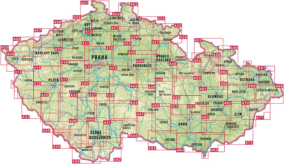
This website https://eshop.kct.cz/klad-map-kct
you will probably need 2 of them 60 and 61-62
mapy.cz are available in offline mode, so you can save data and battery life via mapy.cz app
you will probably need 2 of them 60 and 61-62
mapy.cz are available in offline mode, so you can save data and battery life via mapy.cz app
MyFlickr - fotky ulovene cestou
-

scinkk - inventář fóra

- Příspěvky: 3505
- Registrován: pon dub 2, 2012 12:06
Re: Mapa pro Oderské vrchy
![]() od sobb » sob úno 24, 2018 19:40
od sobb » sob úno 24, 2018 19:40
another option is Shocart - https://www.shocart.cz/cesko-1-40-000/
list of maps: https://www.shocart.cz/user/documents/img/kladT40.jpg
list of maps: https://www.shocart.cz/user/documents/img/kladT40.jpg
We have just one world, but we live in different ones ...
- sobb
- Moderátor

- Příspěvky: 9261
- Registrován: stř bře 7, 2007 9:28
Re: Mapa pro Oderské vrchy
![]() od DerOlleHansen » sob úno 24, 2018 20:05
od DerOlleHansen » sob úno 24, 2018 20:05
Thank you both for the good and quick answers! 
I think, 1:50.000 ist too much details for my purpose, but in both shops I found also 1:100.000 cycle maps with perfect sheet lines:
Which one would you choose?
I think, 1:50.000 ist too much details for my purpose, but in both shops I found also 1:100.000 cycle maps with perfect sheet lines:
- https://eshop.kct.cz/index.php?route=pr ... uct_id=167
This map is from 2001 ... that's 17 years old now ...
- https://www.shocart.cz/cesko-1-100-000/ ... 1-100-000/
For this map I don't find informations about the age of data.
Which one would you choose?
-
DerOlleHansen - nováček
- Příspěvky: 18
- Registrován: pát úno 2, 2018 8:49
- Bydliště: Lubek, Německo
Re: Mapa pro Oderské vrchy
![]() od mike » sob úno 24, 2018 22:07
od mike » sob úno 24, 2018 22:07
Normally, I prefer KCT maps because they're more exact and detailed but for your purpose (general overview and 1:100000) I'd probably choose Shock-Art (pun intended).
-

mike - Moderátor
- Příspěvky: 49405
- Registrován: pát čer 13, 2008 17:27
Re: Mapa pro Oderské vrchy
![]() od DerOlleHansen » ned úno 25, 2018 10:44
od DerOlleHansen » ned úno 25, 2018 10:44
So I tried to order the map 221 Oderské vrchy, Opavsko, Nízký Jeseník 1:100.000 but they do not deliver to Germany. 
But I found a shop in the Netherlands that delivers in many countries (https://www.dezwerver.nl/r/europa/tsjec ... tskaarten/) and payment was possible with MasterCard.
Once you know the exact title of the desired map, Google wil help to find a shop.
Now I am waiting for the postman.
Děkuji za vaší pomoc!
-
DerOlleHansen - nováček
- Příspěvky: 18
- Registrován: pát úno 2, 2018 8:49
- Bydliště: Lubek, Německo
Re: Mapa pro Oderské vrchy
![]() od scinkk » ned úno 25, 2018 11:14
od scinkk » ned úno 25, 2018 11:14
hm agree, and you will need probably only one 1:100000 map. And there are probably signed the roads (in the shocart maps) in the military area which you can use after 1st May, because the Shocart maps are online in this website which I linked when we were talking about your plan.
MyFlickr - fotky ulovene cestou
-
scinkk - inventář fóra
- Příspěvky: 3505
- Registrován: pon dub 2, 2012 12:06
Re: Mapa pro Oderské vrchy
![]() od DerOlleHansen » ned bře 4, 2018 11:53
od DerOlleHansen » ned bře 4, 2018 11:53
The map has arrived and it is perfect as an overview.
It shows the official trails with colour and number, every small village by name and some contour lines and mountain tops.
1:100000 is not good enough for hiking, but will definitely help if you should get lost.
Můj "plán expedice":
It shows the official trails with colour and number, every small village by name and some contour lines and mountain tops.
1:100000 is not good enough for hiking, but will definitely help if you should get lost.
Můj "plán expedice":
- Lubek > Ratiboř: Železnice nebo Spolujízda (Skladujte loď a zařízení)
- Ratiboř > Olomouc: Železnice
- Olomouc > Kozlov: Autobus
- Putování 210 km:

Pramen Odry > Kozlov > Kyjanice > Slavkovský mlýn > Slavkov > Čertovy kazatelny > Boškov > Padesát Lánu > Potštát > Kovárov > Luboměř pod Strážnou > Spálov > Hadinka > Klokocuvek > Hermánky > Jakubcovice > Loucky > Dvořisko > Veselí > Emauzy > Mankovice > Jeseník > Bernartice > Suchdol > Hladké Životice > Bartošovice > Nová Horka > Albrechtičky > Studénka > Petřvaldík > Jistebník > Košátky > Polanka > Klimkovice > Hýlov > Bývalý větrný mlýn > Vřesina > Krásné Pole > Velká Polom > Plesná > Děhylov > Hlučínské jezero > Bobrovníky > Landek Park > Koblov > Rybník Mžíkovec > Starý Bohumín > PP Hraniční meandry Odry > Zabełków > Nádraží Rudyszwałd - Rudyszwałd > Ratiboř: Železnice
- Ratiboř > Travemünde: Skládací člun
- Travemünde > domů: Taxi
-
DerOlleHansen - nováček
- Příspěvky: 18
- Registrován: pát úno 2, 2018 8:49
- Bydliště: Lubek, Německo
Re: Mapa pro Oderské vrchy
![]() od booze » ned bře 4, 2018 18:37
od booze » ned bře 4, 2018 18:37
Military area map and information about entrance
-

booze - outdoor maniak

- Příspěvky: 8315
- Registrován: ned pro 14, 2014 12:56
Příspěvků: 9
• Stránka 1 z 1